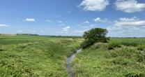
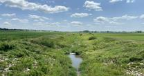
Elliott Creek at Lawton
Future / Actual / Minor
OWP 2.0 WWA Modal Title
01/11/2021, 10:04 PM UTC through 01/11/2021, 10:04 PM UTC
Sender
Sent
- Upstream gauge unavailableDownstream gauge unavailableWarning: no valid ratings curve available. Transformations to and from FEET/CFS/KCFS will not happen.No secondary data available. Transformations for Flow data and a secondary Y axis cannot be made at this time.
Traces and Thresholds Click to turn on/off display
Observed (OBS) 04/13/2025 11:15 PM CDTRecord: 86.1 ftCATEGORY STAGE 
Major Flooding 88 ft Moderate Flooding 84 ft Minor Flooding 80 ft Action 78 ft Reliability of the Forecast:
NOTE: Forecasts are not available. Only observed stages are available for this point.
No forecasts are available for this location
National Water Model Hydrograph
Official NWS streamflow forecasts are produced by NWS hydrologic forecasters for river gauge locations using hydrologic models which are calibrated to that location. This process considers additional guidance and information, including local expertise and experience, to produce the best forecast possible. The NWM output provides supplemental guidance to NWS forecasters and should not be considered an official NWS river forecast.
Flood Impacts
- 91 - The bridge on 150th St is overtopped.
- 88 - Levees are overtopped with major agricultural flooding, and 150th Street will be flooded.
- 87 - The bridge on 170th St is overtopped.
- 84.5 - Emmett Avenue near 110th Street will be flooded.
- 84 - Significant flooding of crop land begins. Water reaches the bottom of the bridge on 170th St.
Gauge Location
Recent Crests
| 1. | 74.07 ft | on 07-28-2024 |
| 2. | 77.48 ft | on 02-27-2023 |
| 3. | 78.88 ft | on 03-10-2020 |
| 4. | 84.89 ft | on 03-13-2019 |
| 5. | 74.28 ft | on 06-25-2018 |
Recent Crests
| 1. | 74.07 ft | on 07-28-2024 |
| 2. | 77.48 ft | on 02-27-2023 |
| 3. | 78.88 ft | on 03-10-2020 |
| 4. | 84.89 ft | on 03-13-2019 |
| 5. | 74.28 ft | on 06-25-2018 |
| 6. | 76.08 ft | on 12-26-2017 |
| 7. | 80.89 ft | on 06-17-2014 |
| 8. | 81.45 ft | on 09-03-2009 |
| 9. | 79.68 ft | on 05-23-2004 |
| 10. | 81.62 ft | on 07-18-1996 |
| 11. | 81.35 ft | on 10-10-1992 |
| 12. | 81.78 ft | on 05-23-1990 |
| 13. | 82.47 ft | on 09-07-1989 |
| 14. | 80.17 ft | on 04-23-1985 |
| 15. | 86.14 ft | on 06-12-1984 |
| 16. | 79.13 ft | on 06-20-1983 |
| 17. | 78.85 ft | on 02-23-1982 |
| 18. | 79.72 ft | on 03-22-1978 |
| 19. | 83.03 ft | on 08-11-1977 |
| 20. | 81.10 ft | on 05-22-1976 |
| 21. | 80.21 ft | on 06-18-1975 |
| 22. | 83.28 ft | on 07-09-1973 |
| 23. | 85.09 ft | on 07-17-1972 |
| 24. | 84.40 ft | on 06-25-1969 |
| 25. | 80.61 ft | on 06-24-1968 |
| 26. | 83.61 ft | on 06-08-1967 |
Historic Crests
| 1. | 86.14 ft | on 06-12-1984 |
| 2. | 85.09 ft | on 07-17-1972 |
| 3. | 84.89 ft | on 03-13-2019 |
| 4. | 84.40 ft | on 06-25-1969 |
| 5. | 83.61 ft | on 06-08-1967 |
Historic Crests
| 1. | 86.14 ft | on 06-12-1984 |
| 2. | 85.09 ft | on 07-17-1972 |
| 3. | 84.89 ft | on 03-13-2019 |
| 4. | 84.40 ft | on 06-25-1969 |
| 5. | 83.61 ft | on 06-08-1967 |
| 6. | 83.28 ft | on 07-09-1973 |
| 7. | 83.03 ft | on 08-11-1977 |
| 8. | 82.47 ft | on 09-07-1989 |
| 9. | 81.78 ft | on 05-23-1990 |
| 10. | 81.62 ft | on 07-18-1996 |
| 11. | 81.45 ft | on 09-03-2009 |
| 12. | 81.35 ft | on 10-10-1992 |
| 13. | 81.10 ft | on 05-22-1976 |
| 14. | 80.89 ft | on 06-17-2014 |
| 15. | 80.61 ft | on 06-24-1968 |
| 16. | 80.21 ft | on 06-18-1975 |
| 17. | 80.17 ft | on 04-23-1985 |
| 18. | 79.72 ft | on 03-22-1978 |
| 19. | 79.68 ft | on 05-23-2004 |
| 20. | 79.13 ft | on 06-20-1983 |
| 21. | 78.88 ft | on 03-10-2020 |
| 22. | 78.85 ft | on 02-23-1982 |
| 23. | 77.48 ft | on 02-27-2023 |
| 24. | 76.08 ft | on 12-26-2017 |
| 25. | 74.28 ft | on 06-25-2018 |
| 26. | 74.07 ft | on 07-28-2024 |


Probability Information
No Images Available
Collaborative Agencies
The National Weather Service prepares its forecasts and other services in collaboration with agencies like the US Geological Survey, US Bureau of Reclamation, US Army Corps of Engineers, Natural Resource Conservation Service, National Park Service, ALERT Users Group, Bureau of Indian Affairs, and many state and local emergency managers across the country. For details, please click here.
Resources
Hydrologic Resource Links
- River Forecast Centers
- NWS Sioux Falls Flooding Resource Page
- NOHRSC Snow Information
- USACE Missouri River Water Management
- USGS National Water Dashboard
- FEMA Flood Insurance Information
- South Dakota Flood Information System
- Iowa Flood Information System
- Missouri River Flood Information System
- Minnesota DNR
- Nebraska Real-Time Flood Forecasting
- ___