-
What is NOAA Atlas 15?
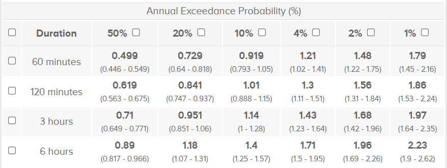
NOAA Atlas 15 is the new authoritative, spatially continuous National Precipitation Frequency Atlas of the United States, currently under development by the NOAA National Weather Service (NWS) Office of Water Prediction (OWP). As with previous Precipitation Frequency Atlases, NOAA Atlas 15 will provide spatially independent estimates of expected precipitation depth (or intensity) for a specified storm duration (e.g., 6 hours), at a particular location of interest (e.g., Tulsa, Oklahoma). The statistically expected precipitation estimates will be presented as exceedance probabilities ranging from 50% average annual exceedance to 0.1%, and will cover storm durations ranging from 5 minutes to 60 days. As an example, a NOAA Atlas 15 precipitation estimate with a 20% average annual exceedance probability has a 20% chance of being exceeded in the year of interest (see table below for a range of examples).
In contrast to NOAA Atlas 14, NOAA Atlas 15 will provide spatially continuous coverage over the entire United States and, for the first time, will also account for future temporal trends (through the year 2100). When published, NOAA Atlas 15 will be the authoritative source for precipitation frequency information across the United States. The current standard, NOAA Atlas 14, is referenced in many engineering design standards and floodplain regulations, published by entities outside of NOAA, and engineers and other practitioners use those standards and regulations to make local decisions (designs for drainage infrastructure, city and regional planning, etc.) Among the civil engineering community, precipitation frequency estimates for various durations are often referred to as Depth-Duration-Frequency (DDF) or Intensity-Duration-Frequency (IDF) curves.
-
Why is NOAA Atlas 15 important?
NOAA Atlas 15 can help communities nationwide become more resilient when planning and designing new infrastructure. This objective will be supported by (1) the delivery of spatially continuous precipitation frequency estimates that cover the entire United States and (2) the incorporation of nonstationary statistical methods and information from climate models to account for future trends.
Although precipitation frequency estimates have existed for many decades (since the late 1930s) and have incrementally improved with advancements in data, science and technology, NOAA Atlas 15 represents a shift from a stationary assumption (i.e., extreme precipitation events do not change significantly over time) to a nonstationary assumption (i.e., extreme precipitation events change over time), a key modification that may impact the manner in which precipitation frequency information is applied.
As a provider of high quality scientific data, NOAA’s objective is to update national precipitation frequency estimates based on the best available and actionable science at the time of development. NOAA is committed to clearly describing the data that are generated, communicating how they were developed and providing widespread access to the information. As this dataset is used for a wide-range of applications, it will be up to users, organizations and government agencies to identify the appropriate bounds for the application of these estimates in the areas in which they have missions and expertise. To help with the transition from the current national standard, NOAA Atlas 14, to NOAA Atlas 15, NOAA plans to partner with several entities and to engage a wide range of stakeholders.
-
Who funded NOAA Atlas 15?
The United States Congress, through the Bipartisan Infrastructure Law (BIL), provided NOAA with funding to revise and update the current precipitation frequency standard, known as NOAA Atlas 14, and develop NOAA Atlas 15.
-
Who is developing NOAA Atlas 15?
NOAA's Office of Water Prediction, which is part of NOAA's National Weather Service, is developing NOAA Atlas 15.
The NOAA Atlas 15 Pilot dataset would not have been possible without the support and contributions of grantees, contractors, and individuals from government, private industry, and academia.
-
How is NOAA Atlas 15 being developed and presented?
NOAA Atlas 15 will consist of two volumes. NOAA Atlas 15 Volume 1 will provide a snapshot of current estimates that account for temporal changes in historical observations. When published, NOAA Atlas 15 Volume 1 will supersede the current NOAA Atlas 14 precipitation frequency estimates.
NOAA Atlas 15 Volume 2 will provide model-based precipitation frequency estimates projected into the future. Volume 2 estimates will be developed by applying adjustment factors to Volume 1 estimates (i.e. future relative changes obtained from downscaled climate model data).
-
What is the NOAA Atlas 15 timeline and when will it be
released?
All NOAA precipitation frequency standards will go through the public peer review process following the timeline presented below. Datasets will be released to the public at different points to ensure NOAA can collect feedback on NOAA Atlas 15, using NOAA’s service delivery model, as guidance.
Montana- 2024 - Pilot project available for early feedback
- September 2026 - Preliminary estimates available for peer review and feedback
- 2027 - Published estimates available for use and application
- 2027 - Preliminary estimates available for peer review and feedback
- 2028 - Published estimates available for use and application
-
What is the NOAA Atlas 15 Pilot?
In order to collect feedback early in the development process, NOAA released the NOAA Atlas 15 Pilot data over the state of Montana on September 26, 2024. With this early release, collaborative NOAA teams, including the National Centers for Environmental Information (NCEI), demonstrated to a large number of stakeholders the nature of the Atlas 15 data to ensure practitioners have the precipitation information they need, upon final publication.
The NOAA Atlas 15 Pilot covered estimates for a subset of storm durations (1 hour to 10 days) and average annual exceedance probabilities (50% to 1%), and was presented in two volumes.
The release of the NOAA Atlas 15 pilot data was intended for comparison and feedback purposes as it did not go through the peer review process. Both the data and web dissemination strategies are subject to change as a result of public feedback received and planned enhancements.
See the NWS Public Notification Statement announcing the NOAA Atlas 15 Pilot. The visualization tool developed for the NOAA Atlas 15 Pilot is available HERE.
-
What are the differences between the NOAA Atlas 15 Pilot and the
full
release?
NOAA released the Pilot data to facilitate understanding of the new framework, development process and methods as well as to provide early insights into the Web dissemination strategy. The Pilot data shared are not final, and may significantly differ from the data shared upon publication and full release. Some major differences are highlighted in the table below.
Pilot Full Release Spatial Coverage Montana United States and Territories Storm Durations 1-hour to 10-days 5-minutes to 60-days Exceedance Probabilities 50% to 1% 63% to 0.1% Methods Preliminary Fully Developed -
How does the NOAA Atlas 15 Pilot differ from the recently
released
NOAA
Atlas 14 Volume 12 study?
The NOAA Atlas 15 Pilot study only covers the state of Montana, whereas the NOAA Atlas 14, Volume 12 study spans the states of Montana, Idaho, and Wyoming. Moreover, the NOAA Atlas 15 Pilot implements nonstationary statistical methods and uses climate model information to project precipitation frequency estimates into the future. In contrast, the NOAA Atlas 14, Volume 12 study assumes stationarity when deriving precipitation frequency estimates. Though NOAA is working to implement NOAA Atlas 15, the NOAA Atlas 14 studies (Volumes 1 - 12) are the existing national standard and authoritative source for precipitation frequency information today. NOAA Atlas 14, Volume 12 data can be found on the NOAA National Weather Service Precipitation Frequency Data Server (PFDS).
-
What happens after the NOAA Atlas 15 Pilot?
NOAA will collect and review feedback on the NOAA Atlas 15 Pilot and consider refining its technical approach based on the feedback received. In the beginning of 2026, NOAA plans to release preliminary NOAA Atlas 15 data for peer review for an area that covers the contiguous United States (i.e., the lower 48 states). The preliminary data and dissemination strategy for this dataset may reflect some of the feedback received during the NOAA Atlas 15 Pilot.
Preliminary estimates will be made available for public peer review for a period that spans 60 calendar days prior to publication. Public peer review will be conducted on two occasions: (1) for areas within the contiguous United States (CONUS) and (2) for areas outside the contiguous United States (oCONUS). Upon publication, feedback collected will be published anonymously, along with an explanation of how the feedback was adjudicated. NOAA intends to share the following feedback form when initiating the public peer review process for CONUS preliminary estimates.
Once the public peer review period is initiated, stakeholders and reviewers are encouraged to share this review opportunity. Feedback from the public is welcome across a wide range of technical perspectives. In particular, feedback is encouraged from stakeholders, government scientists, academic researchers and experts, licensed civil and environmental engineers, state climatologists, transportation and water resource officials, and other technical practitioners with firsthand experience applying precipitation frequency information for a particular need or set of decisions. Comments and feedback on this approach are welcome at atlas15.info@noaa.gov.
-
What happens after NOAA Atlas 15 is published and fully released?
The Bipartisan Infrastructure Law provided NOAA with one-time federal funding to update precipitation frequency estimates nationwide while accounting for trends (i.e., NOAA Atlas 15). After completing peer review and upon publication in 2026 (contiguous United States) and 2027 (outside the contiguous United States), NOAA Atlas 15 will supersede NOAA Atlas 14 as the national standard and will become the authoritative source for precipitation frequency information across the United States.
-
How do I access the current precipitation frequency standard,
NOAA
Atlas 14?
NOAA Atlas 14 data can be accessed on the NOAA Precipitation Frequency Data Server (PFDS). Supporting documentation for NOAA Atlas 14 can be found HERE.
-
How do I receive updates on NOAA Atlas 15?
Please visit this page to subscribe to updates and new information regarding NOAA Atlas 15.
Welcome to the NOAA Atlas 15 Informational Page

News: The public review period for the NOAA Atlas 15 Pilot over Montana is closed. Feedback
received will inform the expansion of the Pilot to the rest of the U.S., with preliminary estimates for
the contiguous U.S. (CONUS) released by September 2026.