Chance of Exceeding River Stage Graphic
This graphic shows chances of the river stage, flow, or volume rising above various
levels during the forecast period. The simulation definitions are below:
- Conditional Simulation (CS) - Represents the chances of the river exceeding the given levels based on the current conditions and latest probabilistic river forecast.
- Historical Simulation (HS) - Represents the chances of the river exceeding the given levels historically (or on average).
The probabilities in these graphics are based on river model simulations that produce
many possible scenarios. The probabilities in the conditional simulation are forecast
river level probabilities that can be compared to the historical simulation (what might
be considered normal based on historical data). It should be expected that conditions
can and will change over such a large forecast period. These outlooks are updated
periodically and should be consulted on a regular basis.
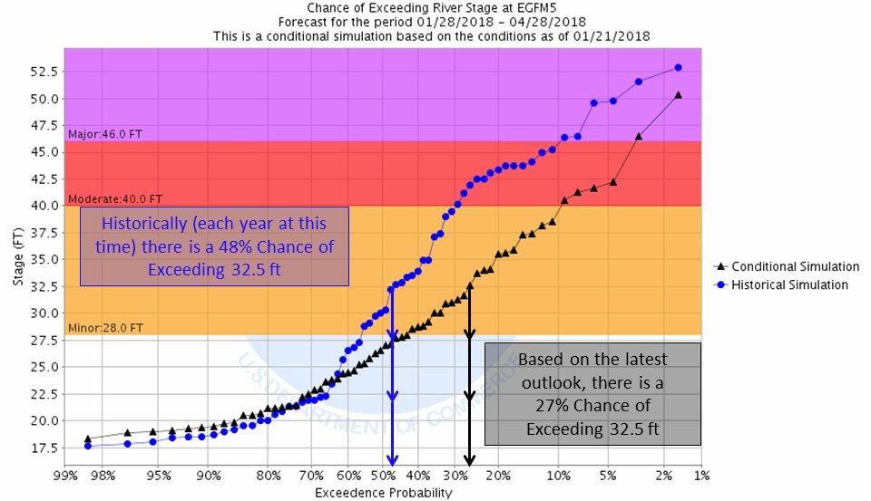
Below is an example image with a description of the data.

The conditional simulation (black) indicates that there is a 27% chance that the river stage will exceed
32.5 feet during the period of 01/28/18 to 04/28/18 at the Red River at East Grand Forks based on the
latest outlook. The historical simulation (blue) indicates that there is a 48% chance that the river stage
will exceed 32.5 feet during the period of 01/28/18 to 05/28/18 for any given year (historically) at the
Red River at East Grand Forks.
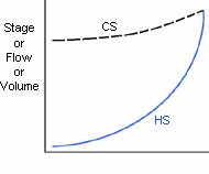
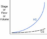
Another way to look at the data is to compare the location's conditional and historical
simulation lines relative to each other (see below).

When the conditional simulation (current
outlook line) is above the historical simulation (normal line), the chances are
greater for higher flows than normal.

When the conditional simulation (current
outlook line) is below the historical simulation (normal line), the chances are
greater for lower flows than normal.
When the two simulations are very close across the entire range, the risk of the river
rising above a certain level is similar to normal.
The following terminology is used when describing floods:
Minor flooding - minimal or no property damage, but possibly some public threat or
inconvenience.
Moderate Flooding - some inundation of structures and roads near stream. Some
evacuations of people and/or transfer of property to higher elevations is necessary.
Major Flooding - extensive inundation of structures and roads. Significant evacuations
of people and/or transfer of property to higher elevations.